Earth’s climate is changing. IBM’s new geospatial foundation model could help track and adapt to a new landscape

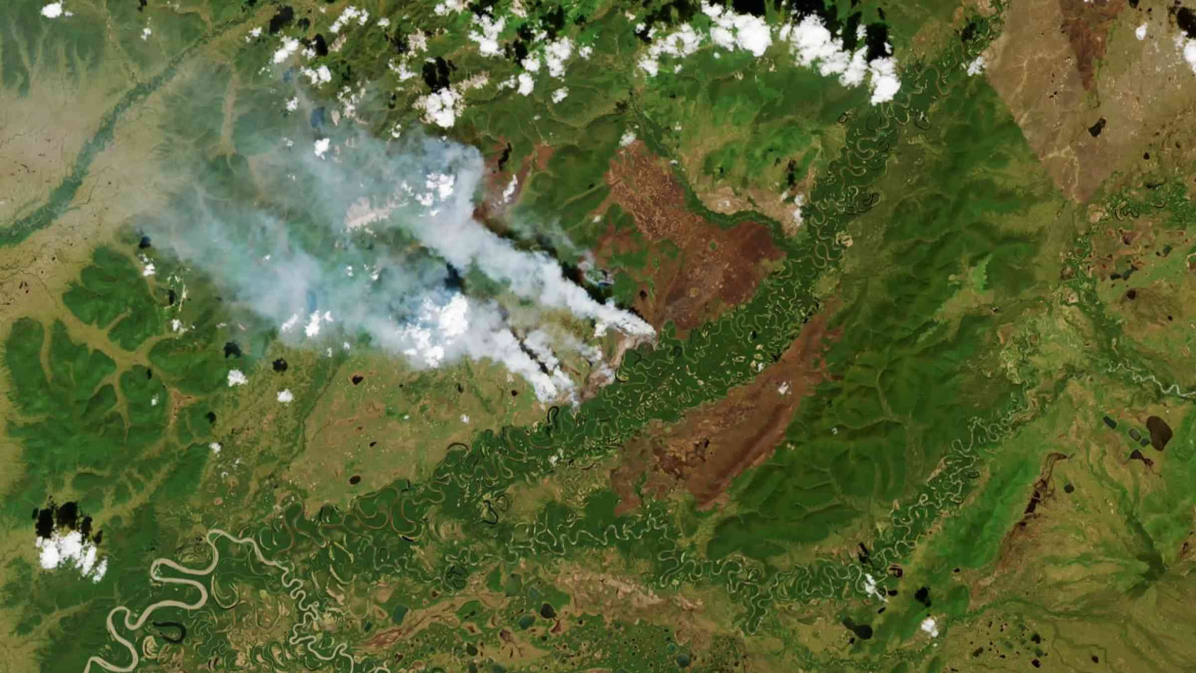
Built from IBM’s collaboration with NASA, the watsonx.ai model is designed to convert satellite data into high-resolution maps of floods, fires, and other landscape changes to reveal our planet’s past and hint at its future.
Nearly a quarter of the world’s population now lives in a flood zone, and that number is expected to climb as rising seas and heavier storms triggered by a changing climate put more people at risk. The ability to accurately map flooding events can be key to not only protecting people and property now but steering development to less-risky areas in the future.
A new geospatial foundation model unveiled today by IBM is designed to enable first steps toward this goal by converting NASA’s satellite observations into customized maps of natural disasters and other environmental changes. The model, part of IBM’s watsonx.ai geospatial offering, is planned to be available in preview to IBM clients through (EIS) IBM Environmental Intelligence Suite during the second half of this year. Potential applications include helping to estimate climate-related risks to crops, buildings, and other infrastructure, valuing and monitoring forests for carbon-offset programs, and developing predictive models to help enterprises create strategies to mitigate and adapt to climate change.
As part of a Space Act Agreement with NASA, IBM set out just four months ago to build the first-ever foundation model for analyzing geospatial data. Foundation models have revolutionized natural language processing (NLP) by allowing developers to train one model on raw text, and with extra training, customize the model for other NLP tasks. Previously, users had to train a new model for each task, which required extensive data curation and compute. Rather than train a foundation model on words, IBM Research taught a model to understand satellite images. Researchers pre-trained NASA’s Harmonized Landsat Sentinel-2 (HLS-2) data. The HLS data provides consistent surface reflectance data from the Operational Land Imager (OLI) aboard the joint NASA/USGS Landsat 8 satellite and the Multi-Spectral Instrument (MSI) aboard the European Union’s Copernicus Sentinel-2A and Sentinel-2B satellites. The combined measurement helps enable global observations of the land every two to three days at 30 meter spatial resolution.
They then fed the model hand-labeled examples to teach it to recognize things like the extent of historic floods and fire burn scars, as well as changes in land-use and forest biomass.
Using the model is designed to be simple as users only need to select a region, a mapping task, and a set of dates. For example, if a user types “Port-de-Lanne, France” into the search bar and selects the dates December 13-15, 2019, the model highlights in pink how far the flood waters extended. Users can overlay other datasets to see where crops or buildings were inundated. These visualizations can help with future planning during similar disaster scenarios: they provide information that could help mitigate flood impacts, inform insurance and risk management decisions, plan infrastructure, respond to disasters, and protect the environment.
IBM built the model on a masked autoencoder for processing video and adapted it to satellite footage. To teach the model to understand sequences of images unfolding through time, researchers blanked out parts of each image and had the model reconstruct it. The more images it reconstructed, the better it became at understanding how they related to each other. They then fine-tuned the model for specific tasks like classifying and segmenting images. This fine-tuning workflow was based on PyTorch with an enhanced segmentation library that allowed researchers to work with spatiotemporal data.
To improve the model’s efficiency, researchers also shrank the size of satellite images, allowing them to process the data in smaller chunks and get away with fewer GPUs. They then trained the model using over 5,000 GPU hours on IBM Research’s Vela supercomputer.
Early results look promising. In tests, researchers saw a 15% improvement in accuracy compared to state-of-the-art deep learning models for mapping floods and burn scars from fires , using half as much labeled data. IBM estimates this model could speed up geospatial analysis by three to four times, and can help reduce the amount of data cleaning and labeling required in training a traditional deep-learning model.
We see how this technology can be applicable to businesses as they look for easier and faster ways to analyze and draw insights from climate data. For example, disaster response teams could use a solution like this to help prepare for a fire impacting residential housing. Or, this solution can help a large consumer goods company to better understand macro trends like climate change, severe weather or geopolitical risk that impact where they are currently buying their raw materials from and where they might want to consider purchasing those resources in the future. It can also help a large agribusiness to better measure, track and mitigate the impact of their farming practices on the local environments and surrounding communities by better understanding soil degradation, water conservation activities or how to reduce pollution caused by run-off from fields to local bodies of water.
IBM is also involved in additional projects around geospatial mapping, working with Esri and other companies to help organizations uncover a richer spatial context of a business’s assets and operations.
Try out the latest in geospatial AI
The preview version of the base geospatial foundation model and suite of fine-tuned models, all running on watsonx.ai, is planned to be available through IBM EIS.1 We believe this release will be invaluable for data scientists, developers, researchers, and students.
The preview trial makes these two sets of tools available within EIS. It includes APIs for inference fine-tuned models to drive developer engagement. We also offer sample solutions that apply these models, create triggers, and leverage work queues to drive a downstream operational system.
If you’re interested in joining the waitlist to test out the preview version within IBM EIS, click here.
