JRC scientists have developed a tool to estimate flood water depth and improve the accuracy of flood extent maps by combining satellite images with topographic data.
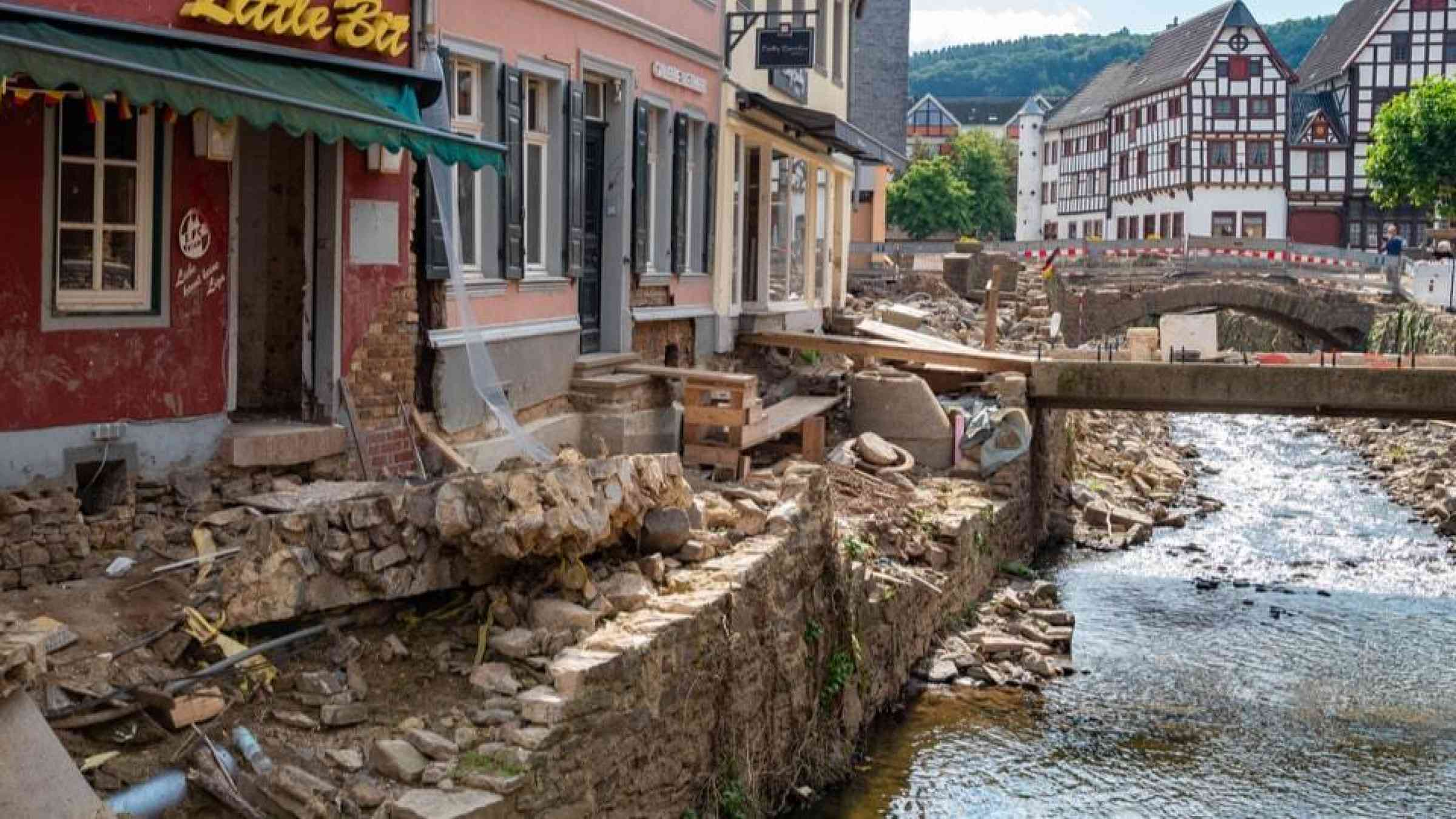
As devastating floods threatened lives and livelihoods in Central and Eastern Europe, maps from the Copernicus Emergency Management Service (CEMS) have shown the extent of the damages in Germany, Poland, Slovakia, Romania, Hungary and Austria. A JRC-developed tool, still under testing, and foreseen as a future evolution in CEMS will improve flood delineation accuracy and floodwater depth.
Satellites images are already used to map flooded areas to monitor the evolution of floods, and support recovery efforts.
However, satellite images have also limitations as cloud cover, dense vegetation or large infrastructure in urban areas can obstruct or degrade the signal of satellite sensors. In addition, in the case of floods, there's another drawback as satellites cannot sense water depth.
To address these gaps, JRC scientists developed the Flood Extent Enhancement and Water Depth Estimation Tool (FLEXTH). The tool combines satellite-derived flood extent maps with readily available topographic data to rapidly estimate flood depth and spread the flood extent into areas not covered by the satellite sensor.
The importance of accurate flood mapping
Inland flooding is a key risk for Europe due to the extent of settlements exposed, the frequency of the hazards, the risks to human lives associated with flash floods and the limited adaptation potential to pluvial flooding.
Floods are among the most devastating natural hazards, as they take lives, destroy infrastructure, damage biodiversity and lead to high economic losses. A warming above 3°C could double the costs of damage and people affected by precipitation and river flooding.
Flood water depth is a critical factor in assessing the impact of a flood, in particular when it comes to assessing the damage caused to buildings or other infrastructure. Knowing flood water depth can also support rescue operations by helping to decide which means to allocate (e.g. helicopter or boat) and the equipment and quantity to use (e.g. hoses and water pumps).
The FLEXTH method for measuring water depth
Until now, water depth estimations relied heavily on ground-based observations, as satellites cannot sense water depth. FLEXTH overcomes the limitations of satellite data by providing accurate information on both the water depth and the extent of floods.
FLEXTH manages to do this by combining a flood delineation map of an ongoing or past flood event - including riverine, coastal or pluvial - and combining it with topographic information to fill the gaps where satellite data is unavailable or unreliable.
Key benefits and features
The FLEXTH tool is available as open-source Python code and offers several advantages, such as computational efficiency for processing large areas.
Used in conjunction with different data sources such as the Global Flood Monitoring product of the Copernicus Emergency Management Service (CEMS), FLEXTH will help in better quantifying flood impacts and ultimately contribute to reduce the disastrous consequences of floods worldwide.
CEMS is implemented by the JRC in cooperation with the Commission's departments for European Civil protection and Humanitarian Aid (ECHO), and for Defence industry and Space (DEFIS). The JRC manages the service implementation and provides service evolution based on scientific research.