For more than a decade, MapAction has provided support to Madagascar's national disaster management agency, managing and visualising key data to support decision-makers, during tropical storms and cyclones. Now the focus is on strengthening the island's preparedness for any future disasters. This includes a nationwide review of overall information management capacity and gaps, training of stakeholders, tools to automate processes and a data-driven anticipatory action plan to reduce future suffering.
"Those who have good preparedness will be safe from danger." So reads the maxim of Madagascar's national disaster management agency (Bureau National de Gestion des Risques et des Catastrophes - BNGRC), whose job is to develop and implement contingency plans for natural disasters.
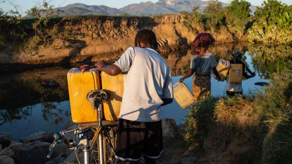
No easy feat. Madagascar is one of the 10 poorest countries in Africa, meaning resources for this kind of work are stretched. Chronic malnutrition affects nearly 40 percent of children, according to data from the World Food Programme (WFP). More than 90 percent of the 28 million people who live in Africa's largest island subsist on less than $3.10 p/day, according to the same source. Regular natural disasters add to the chronic food insecurity.
"The south of Madagascar is affected by a recurrent drought and the southeast is prone to recurrent cyclones and flooding," states a report by WFP. "In these regions, up to 1.31 million people face high levels of acute food insecurity."
The BNGRC and partner agencies have a huge challenge to maximise resources for at risk-communities.
MapAction has been working in Madagascar since 2012, providing maps and information management services for emergency respondents during four natural disasters: Tropical Cyclone Freddy (February 2023), Batsirai (February 2022), Enawo (March 2017) and Tropical Storm Irina (March 2012). These efforts were a combination of in-person responses with UN agencies and partners, as well as remote support.
Fighting the climate emergency
In recent years, with natural disasters on the rise due to the climate emergency, humanitarian data use is changing. With the right understanding of risk and data-backed mitigation scenarios, disaster managers and partners in countries on the frontlines of the climate emergency, like Madagascar, can reduce future suffering. Anticipatory actions help save lives by ensuring local disaster managers have the data, tools and capacity they need to mitigate the worst effects of FUTURE disasters. A fire extinguisher puts out fires; an alarm helps prevent the worst flames.
Data v. future disasters
For several years MapAction has been helping local disaster agencies to adopt the specialist and complex data standards that are required to use anticipatory action tools. This helps them access vital early funding based on pre-agreed 'triggers' signalled by data. These tools combine local knowledge of risks with things like climate data, enabling money and resources to be used to protect at-risk communities shortly before a disaster strikes.
In 2023 MapAction created a dedicated Anticipatory Action team and started contributing to the European Union designed INFORM Subnational Risk models, initially in Eswatini and most recently in Madagascar. MapAction's Daniel Soares and Piet Gerrits co-led a consultation workshop with more than 40 stakeholders from UN agencies, government, academic institutions and civil society organisations in Madagascar in early 2024.
The main outcome was the agreement on the so-called Madagascar INFORM Framework and the initial data collection. In total, 195 indicators - which cover hazards and exposure, vulnerability and coping capacity - were identified, with 88 flagged as very relevant. These are all standard indicators for disaster scenarios. UNICEF also facilitated the inclusion of indicators designed to identify at-risk children.
The data modelling work was preceded by extensive mapping of the disaster response landscape, as well as professional development events for stakeholders in Madagascar, to strengthen the country's overall capacity to use geospatial and information management tools.
In 2022, MapAction decided to increase its focus on Madagascar, resulting in a spate of new programmes. That same year, MapAction joined Start Network, a network of 90 local and international organisations whose "mission is to create a new era of humanitarian action that will save even more lives."
Mapping training & food security
In 2023, MapAction conducted a training programme for staff from Start Network member organisations in Madagascar: team members from our organisation provided hazard data analysis and mapping training for tech representatives from civil society organisations within Start Network.
Tool to automate maps in disasters
Since then, longtime MapAction team member Ant Scott has supported Start Network in developing processes to allow the Vulnerability Assessment Tool (video demo) to be shared and published online. The tool was developed in Madagascar, designed for GIS (Geospatial Information Systems, or mapping/spatial analysis tools) professionals at civil society organisations and local disaster managers. It's a predictive model to understand which districts are most at risk in a cyclone, storm or hurricane.
This vital information helps decision-makers to get an overview of a crisis: the places and communities most affected or exposed; the threats to health, wellbeing and security. The work MapAction has been supporting, using the Felt mapping platform, allows the results of the tool to swiftly be disseminated online and combined with other data in a way that gives easy access to everyone involved.
Research: gaps & opportunities
Other work has focused on identifying strengths and weaknesses in the country's overall information management and geospatial sector. MapAction's Anticipatory Action Analyst, Orla Desmond, met with dozens of stakeholders from government, NGOs and the academic sector in early 2024 in the Madagascar capital Antananarivo, part of a comprehensive 'mapping' of the disaster stakeholder landscape. The emphasis was on GIS strengths and weaknesses and anticipatory action. Discussions were held about GIS data sources, the quality and accessibility of data, and the types of data required by organisations carrying out anticipatory actions. Opportunities for improvements were then shared with Start Network in Madagascar as part of a 27-page comprehensive report.
Next steps
Our team also conducted training in parallel on developing baseline maps in a crisis - Who, What, Where maps (known in the industry as the '3Ws') - a fundamental trio for any decision-maker in an emergency.
Yet our work in Madagascar is far from finished. GIS consultant Ant Scott and data scientist Carola Martens are returning to the island in the Southern African Development Community (SADC) on 17th June 2024 to conduct further training and hands-on workshops in GIS and data management skills. These will be for key personnel identified during the research and other local staff involved in disaster management and anticipatory action planning. The impact will be to strengthen the country's overall response and planning capacity for disasters.
Stay tuned for more risk models
Meanwhile, MapAction's work building INFORM RISK Subnational models -- data sets to mitigate hazards and disasters and protect at risk-communities -- continues worldwide.
"The partnership between INFORM and MapAction greatly increases our capacity to support countries to develop INFORM Subnational risk models," says Andrew Thow, Programme Manager at the UN, an INFORM partner. "These models help countries understand their risks and inform planning and programming to better prevent and prepare for crises and disasters," adds Thow.
