Igniting change: 5 AI innovations to help extinguish wildfire risks
Artificial intelligence (AI) has had some bad press - threats to authenticity through deep fakes and plagiarism, threats to fairness through bias and reinforcement of systemic prejudices, threats to the workforce through the automation of tasks that would otherwise provide human employment, and many more. All of these concerns are legitimate. However, AI is also showing its value as a transformative technology that could change the way we manage threats. One such threat is wildfire.
Traditional methods of assessing fire damage often rely on labour-intensive, time-consuming processes that can delay critical response efforts and prolong uncertainty for affected communities. AI-powered tools represent a paradigm shift by enabling rapid analysis of all kinds of wildfire-related data, enhancing the overall efficiency of disaster response and recovery operations.
Discover these innovations, and more, below:
1. Predicting fires with hikers’ snaps
A new mobile phone app, NOBURN uses AI to help predict and prevent wildfires. Developed by Australia’s University of Adelaide, the app can analyze photos taken by bushwalkers in fire-prone areas, assessing potential fuel loads and predicting severity and spread of possible fires. This crowdsourced data mimics expert evaluations, enabling widespread monitoring without needing experts on site.
Inspired by the devastating 2019-2020 Black Summer fires, NOBURN aims to raise awareness about the benefits of AI in disaster prevention and enhance situational awareness for bushfire commanders. This initiative could save millions in damages and protect lives by utilizing public participation in bushfire risk assessment.
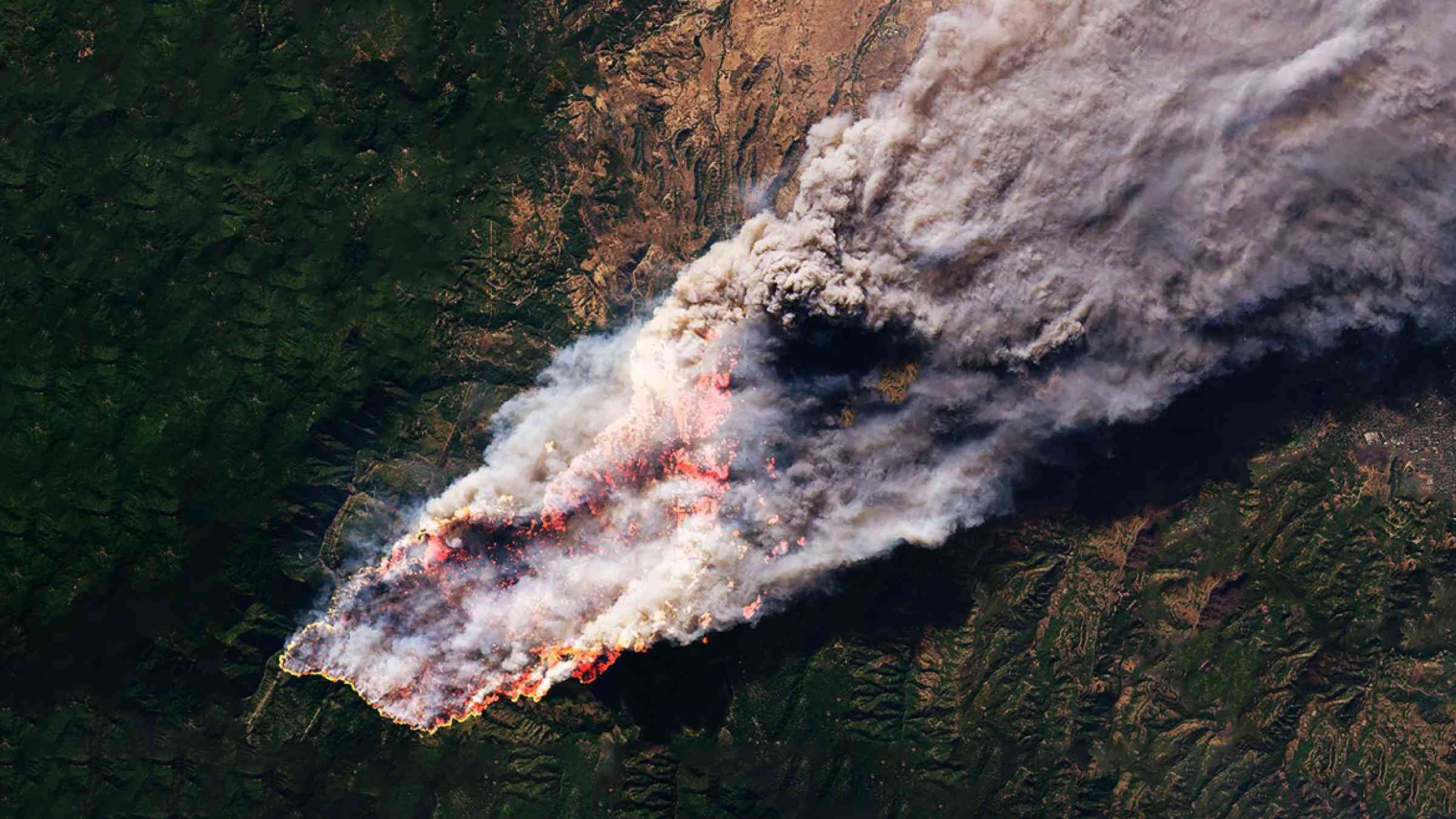
2. Precision monitoring and prediction, in real time, on the frontline
NASA's "Wildfire Digital Twin" project is set to revolutionize wildfire management by providing real-time monitoring and prediction tools. Funded by NASA's Earth Science Technology Office and FireSense Program, this tool uses AI to forecast fire paths and harmful air pollution, integrating data from a range of sensors and satellite imagery to create highly precise models. These models, with a resolution vastly superior to those currently used, can be generated quickly, aiding first responders in real time.
The project aims to offer firefighters timely information even in remote locations without internet access. As well as helping in immediate disaster response but also supports long-term research on global wildfire trends, especially in carbon-rich boreal forests. By improving the accuracy and speed of wildfire predictions, NASA's technology enhances efforts in disaster risk reduction, potentially saving lives and reducing environmental damage.
3. A space-age solution for early wildfire detection
Australian scientists have developed an advanced wildfire detection system using AI-equipped CubeSats – miniature cube satellites that are relatively inexpensive to produce and operate. This breakthrough allows for detecting fires 500 times faster than traditional ground methods. Funded by SmartSat CRC and led by the University of South Australia, the Kanyini mission employs AI to analyze hyperspectral imagery directly in space. The onboard AI reduces data to 16% of its original size and uses 69% less energy.
This early detection system identifies smoke before fires intensify, thus enabling quicker responses. With this innovation, bushfires can be detected within minutes, providing crucial early warnings. The team aims to operationalize the Kanyini mission by 2025 and eventually commercialize the technology for broader use in disaster risk reduction.
Discover CubeSat fire detection
4. A neural network model to cut peatland fire risks
Peatland fires are on the increase, as a result of changing land use and hotter, drier conditions from climate change. Researchers at Finland’s Aalto University have designed an AI model that can predict and reduce fires in peatlands. In a study focused on Central Kalimantan in Indonesia, the neural network model accurately forecast fire occurrences and assessed management strategies. By analyzing land cover and pre-fire conditions, the model identified interventions to reduce fires by 50-76%.
Converting shrubland to swamp forests and blocking drainage canals were found to be most effective interventions – but these measures are costly. This new tool offers critical insights for policymakers to implement effective disaster risk reduction measures, potentially protecting lives, property, and reducing carbon emissions.
See AI in action to reduce peatland fire risk
5. Aerial photo analysis for speedy fire damage assessment
After wildfires have blazed through settlements, residents and insurers need to assess damages to property and begin repairs and reconstruction. Any delays can prolong disruption and incur mounting costs. Researchers at Stanford University and Cal Poly have developed an AI tool to speed up the process by quickly identifying wildfire-damaged buildings using aerial photos. This innovation, DamageMap, allows for rapid assessment, significantly faster than the traditional method of manual inspections. By analyzing post-fire images, the platform can provide immediate information on building damage with over 92% accuracy.
This tool aims to assist first responders and displaced residents by pinpointing damaged structures, aiding in quicker recovery efforts and insurance claims. While not replacing in-person assessments, DamageMap offers a scalable solution to enhance disaster risk reduction and recovery processes. The research highlights the potential of AI in improving emergency response and helping communities rebuild more efficiently after wildfires.
Discover fast fire damage assessments
A smarter toolkit for a fiery future
As wildfires intensify and become more frequent due to climate change, we need to up our game in predicting and averting fires, allocating resources and assessing damages. AI-driven tools, such as those discussed above, offer promise in enhancing the speed and accuracy of wildfire risk reduction, response and recovery.
Smart innovations and new technologies – including AI tools – are being designed and implemented to reduce all kinds of disaster risks. PreventionWeb continues to crunch the data to bring you the newest developments from the frontiers of disaster risk reduction.
View more content on AI uses in DRR
Explore our wildfire series
Blaze blowback: 7 surprising spillovers from wildfire
8 blazing new technologies that could spark change in wildfire risk reduction