Marine heat waves make tropical storm intensification more likely
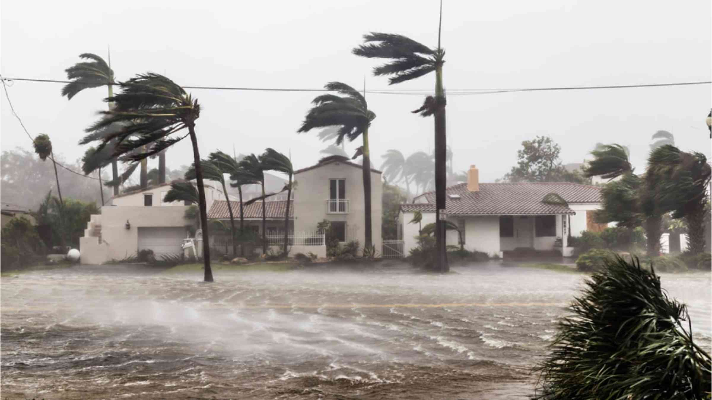
Hurricane Helene started out on 24 September as a tropical storm churning through the Gulf of Mexico. By 26 September, it had grown into a category 4 hurricane, experiencing rapid intensification over the abnormally warm waters of the Gulf.
Tropical cyclones in the Gulf of Mexico and northwestern Caribbean Sea are 50% more likely to undergo rapid intensification on average during such marine heat waves, according to a study published in August in Communications Earth and Environment. These types of hurricanes are more dangerous as they make landfall because their intensity is harder to predict.
"If you're looking for a better environmental predictor [for rapid intensification], a clear path is to use marine heat waves," said Soheil Radfar, a hydrologic modeling expert at the University of Alabama and first author of the study.
A tropical cyclone is said to be undergoing rapid intensification when it experiences a 35-mile-per-hour (56-kilometer) or greater increase in maximum wind speed over a 24-hour period. Most category 3-5 hurricanes experience at least one such event during their lifetime, including five particularly costly U.S. storms that passed through this region: Katrina (2005), Harvey (2017), Ian (2022), Ida (2021), and Michael (2018).
Marine heat waves occur when sea surface temperatures in a given area exceed a threshold for 5 or more consecutive days. The threshold is based on the baseline temperature of the ocean and varies by season and location.
Along with causing damage to marine life, ocean heat waves are one of several factors that can intensify a tropical cyclone. Although these interactions are complex and not fully understood, Radfar explained that a key factor linking both extreme climate events is the availability of moisture in the air. During a marine heat wave, the sea surface is warmer than usual, making it easier for water to evaporate and fuel tropical storms.
More likely intensification
To better understand this relationship, Radfar and his colleagues analyzed the behavior of marine heat waves and tropical cyclones that occurred from 1950 to 2022. They used a database of tropical storms to identify 738 events that matched the criteria for rapid intensification in the Gulf of Mexico and northwestern Caribbean.
They identified marine heat waves from a weather reanalysis-an estimate of past conditions that combines data and simulations to fill areas without records. In this study, the researchers used the European Centre for Medium-Range Weather Forecasts Reanalysis 5 (ERA) data set.
Then they isolated heat waves that occurred within 10 days and 125 miles (200 kilometers) of a rapid intensification event. Roughly 70% of tropical storms during the time period passed over at least one marine heat wave.
The data highlighted three hot spots where marine heat waves appeared to increase the likelihood of rapid intensification up to fivefold: near the Cayman Basin in the northwestern Caribbean Sea and the Bay of Campeche and the Yucatán Channel in the Gulf of Mexico.
The researchers also found that the duration of marine heat waves in the area has increased from 36.5 days per year to 49.5 days per year.
Because of global warming, the influence of marine heat waves on hurricanes may become stronger, Radfar said, though he pointed out that heat waves may not affect the number of storms.
David Francisco Bustos Usta, a physical oceanographer at the Universidad de Concepción in Chile who was not involved in this research, agreed with most of the study's conclusions. "As global warming increases, you obviously have more energy to power hurricanes," he said. Bustos Usta's own work has shown that marine heat waves are likely to be longer and warmer in the future. He thinks the frequency of tropical cyclones could indeed increase.
These heat waves make predicting tropical cyclones and preparing for their landfall challenging. Radfar explained that "when we have a favorable environment, hurricane forecasting is harder, not easier." That's why he thinks it's important to continue studying marine heat waves. Scientists need to understand how they interact with tropical storms "to better inform our rapid intensification prediction models, as well as governments and federal agencies," he said.