New study reaffirms Indigenous lands key to adapting to climate change in Brazil
- A recent study adds to growing literature showing that Indigenous lands and conservation units are much more effective at regulating climate than multiuse areas.
- The authors found that Indigenous lands and conservation units contribute more to climate regulation than multiple-use areas, underscoring the crucial role that protected areas play in regional water supply services and mitigating ongoing climate change.
- However, persistent degradation pressures from forest fires, deforestation and global climate change are increasingly challenging the capacity of protected areas to regulate climate.
In April, Brazil's president Luiz Inácio Lula da Silva recognized an additional two Indigenous territories, including one 32,000-hectare (more than 79,000-acre) territory belonging to the Karajá peoples in Mato Grosso. According to a new study published in the journal Perspectives in Ecology and Conservation, this act alone could quite possibly be the best investment not just for Indigenous rights, but for securing the future climate stability of the state.
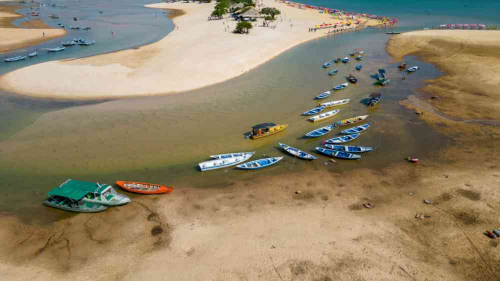
The state of Mato Grosso straddles two of Brazil's largest biomes: The Amazon covers around two-thirds of the state, and the Cerrado covers the other third. Most of the remaining forest is protected within conservation units and Indigenous lands, which have stood as barriers to deforestation, forest fires and degradation. But Mato Grosso is also Brazil's leading producer of soybeans and meat, and both have grown at the expense of the region's native Cerrado and Amazon vegetation.
According to this study on Indigenous lands and conservation units in Mato Grosso, these protected areas are crucial for slowing down and regulating climate change impacts. However, the same study shows, this barrier is weakening. The ability of protected areas to keep the forest intact has already begun to decline, especially on the southern edge of the Amazon, where forest degradation has been associated with intense droughts and forest fires.
"Mato Grosso is experiencing intense changes due to the expansion of pasture and agriculture," Hellen Almada, a researcher at the Vale Institute of Technologyin Brazil and the lead author of the study, told Mongabay over WhatsApp. "Assessing whether external pressures compromise the capacity of protected areas to maintain their ecosystem services is crucial."
The paper uses various datasets to analyze how human and natural disturbances affect the ability of Indigenous lands, conservation units and private, multiuse areas to regulate things such as regional temperature and atmospheric water cycling. By assessing the differences in evapotranspiration, surface temperature and surface albedo over a 20-year period, they were able to show that conservation units and Indigenous lands contribute more to climate regulation than multiple-use areas or lands outside of Indigenous lands and conservation units.
In recent decades, the increase in pasture lands and crops, much of it for meat or animal feed production, has transformed the landscape in Mato Grosso. The authors analyzed geospatial data, showing that native vegetation in Mato Grosso has decreased by 10% in the last two decades, from 73% in 2000 to 63% in 2020. Most of it has been converted to pasture and crops, such as soy. Of this, 69% is located in the Amazon and 31% in the Cerrado. The increased fragmentation of forests and rising global temperatures means that forests are much more susceptible to both drought and fires. For example, the authors found that intense droughts increased the burned area in conservation units and Indigenous lands in both the Amazon and Cerrado.
Still, the study found that protected areas had three times fewer fires per square kilometer (per 0.38 square mile) than other areas in the Amazon, and they help to maintain low temperatures, low albedo (the fraction of light reflected from the Earth) and high evapotranspiration (the combined process of evaporation and transpiration), even during extreme droughts. This means that protected areas are not only essential for preserving forests and native vegetation, but it also means that as temperatures continue to increase, protected areas will be even more crucial for regulating the regional effects of climate change.
"The biggest takeaway for me is how intertwined global and local factors are in shaping ecosystem change," Almada said.
For example, the greater susceptibility to fire of protected areas can be attributed to warming temperatures and frequency of droughts. The fires themselves can alter the energy balance of protected areas, intensifying local and regional impacts of native vegetation loss and leading to permanently degraded states.
"This highlights the critical importance of integrated approaches to conservation and land use that address both climate change and local human activities," she told Mongabay.
The findings are not necessarily surprising, said Eugenio Arima, an associate professor who teaches geography and landscape ecology at the University of Texas at Austin and who wasn't involved with the study. "We know that forested areas have higher ET [evapotranspiration], lower albedo, and lower LST [surface temperature] variability throughout the day. There is plenty of evidence in the literature that CUs and ILs [conservation units and Indigenous lands] are effective in protecting land cover," he told Mongabay in an email. "Therefore, more protection will benefit the regional climate," he added.
Other studies have come to similar conclusions. For example, 2023 research published in Nature Sustainability revealed substantial forest cover loss in the Brazilian Amazon due to policy change and extreme climate events from 2000-21 and showed that Indigenous territories and protected areas are leading contributors to conservation in the Amazon. "This study found a similar story in Mato Grosso from 2000 to 2020," said Yuanwei Qin, the lead author of the Nature Sustainability study who was not affiliated with this paper. They also showed that Indigenous territories and conservation units significantly reduced land surface temperature, evapotranspiration and albedo in the Amazon and Cerrado, he added.
For example, in the Amazon of Mato Grosso, the multiple-use areas had a 15% reduction of native vegetation, including forest, and the land surface temperature increased by 4.5%, while protected areas had little native vegetation loss and only about a 1% surface temperature increase. "This is a big difference," he wrote.
The study comes a year after Brazil suffered one of its worst droughts on record in the Amazon, made an estimated 30 times worse by climate change. In 2023, deforestation in the Cerrado reached record highs, and the savanna officially surpassed the Amazon as being the most deforested biome.