Rising seas boost tsunami impacts on distant shorelines
Modeling suggests that rising sea levels will render Southern California ports increasingly vulnerable to waves from distant-source tsunamis.
Tsunami waves can propagate tens of thousands of kilometers over open water. And although the waves that roll up on distant shorelines generally aren’t the type to overtop buildings, they can still be highly destructive, particularly if they hit infrastructure-laden facilities like ports. Researchers have now shown that as sea levels rise, potentially damaging tsunami waves can be produced by lower-magnitude earthquakes. These findings highlight an important, yet often unconsidered, consequence of rising seas, the researchers have suggested.
Vulnerable Infrastructure
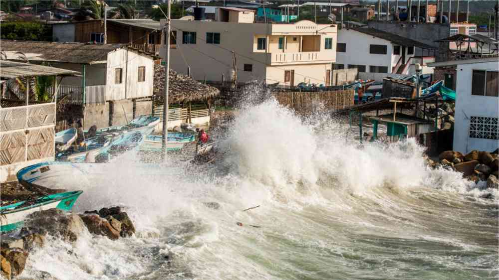
The ports of Los Angeles and Long Beach in Southern California are the largest ports in North America. Together, these sprawling complexes—spanning more than 10,000 acres—receive more than 20% of the cargo entering the United States. But both facilities are vulnerable to strong currents set in motion by tsunami waves originating from faraway earthquakes: In 1960 and 1964, the ports were damaged after major tsunamigenic earthquakes occurred in Chile and Alaska, respectively. In both cases, currents and inundation caused tens of millions of dollars in damage
And these ports are bound to experience similar events in the future, said Tina Dura, a paleoseismologist at Virginia Tech in Blacksburg. The culprit will likely be a tsunamigenic earthquake launched from the Alaska-Aleutian subduction zone, she said. That’s because sections of this subduction zone, the birthplace of the 1964 temblor, send waves directly toward the ports of Los Angeles and Long Beach. “The orientation is just right for Southern California,” said Dura.
Boosting the Baseline
But getting a handle on how frequently such waves might roll into these ports requires an understanding of rising sea levels, one of the major effects of climate change, said Dura. Sea level rise—caused primarily by the melting of ice sheets in Greenland and Antarctica and the thermal expansion of seawater as the planet warms—boosts the baseline water level, she said, meaning that coastal defenses like barrier walls are less effective. “The inundation will be worse, and the potential for strong currents will be exacerbated.”
Dura and her collaborators considered two projections of greenhouse gas emissions—Representative Concentration Pathways (RCPs) 2.6 and 8.5—combined with models of sea level rise at the ports of Los Angeles and Long Beach. Such location-specific analysis of sea level rise is key, said Dura, because sea levels don’t rise uniformly all over the planet. “Southern California is a place that seems sensitive to melt in the West Antarctic Ice Sheet,” said Dura. “Our projections took that into account.” The team assembled a suite of values of relative sea level rise in Southern California for the two emissions pathways for every decade in the 21st century.
The researchers then combined those data with models of tsunamigenic earthquakes ranging in magnitude from 8.0 to 9.4 occurring in the Alaska-Aleutian subduction zone and their associated tsunamis. Finally, Dura and her colleagues folded in the effects of tides. The impact of a tsunami will differ depending on the tidal stage, said Dura. “If it hits at high tide, it’s going to have a much larger impact than at low tide.”
Taking into account all of those inputs, the team assembled distributions of maximum nearshore tsunami height for the ports of Los Angeles and Long Beach through the year 2100. They then examined the earthquake magnitude that would be required to have a 50% probability of producing a variety of tsunami heights clustered around 1 meter. That’s a representative height, said Dura. “The ports have had tsunami heights of around half a meter, historically, multiple times.”
A Shift Toward Smaller Quakes
Dura and her collaborators found that today, a magnitude 9.1 earthquake generates tsunami waves that have a 50% chance of exceeding 1 meter. But in the future, assuming the RCP2.6 scenario, the waves produced by a magnitude 8.8 earthquake would have the same probability. And in the RCP8.5 scenario, a significantly smaller earthquake—magnitude 8.0—would be sufficient. “That’s quite a big shift,” said Dura. “A magnitude 8.0 is about 6.7 times more frequent than a magnitude 9.1.”
And it’s important to remember that there are other sources of tsunamis besides earthquakes, said Dura. The undersea volcano Hunga Tonga–Hunga Ha’apai, which erupted in the Pacific Ocean on 14 January, sent tsunami waves rushing over the islands of Tonga. “It was an incredibly low probability event, but it happened, and it made tsunami waves in California comparable to or greater than any historical distant-source tsunami,” Dura told Eos.
The team’s results, which were published in December in Nature Communications, make sense, but they’re sobering, said Miguel Esteban, a coastal engineer at Waseda University in Tokyo who was not involved in the research. “There [are] going to be a lot of investments that have to be made. Somebody is going to have to pay for these coastal defenses in the future.”