Türkiye & Syria earthquake reminds all of the unmitigated risks of a deadly disaster
Multiple earthquakes, the strongest being of 7.7 magnitude, struck southern Türkiye and northern Syria on 6 February 2023. The earthquake was extremely powerful, and more deadly because it struck at a relatively shallow depth and was followed by a second major shock and thousands of aftershocks. More than 40,000 people in Türkiye and over 5,800 in Syria have been reported dead. Flattening buildings, the full scale of the catastrophe is still emerging; its overall impact on the people, economy, and environment is colossal and recovery will be extensive.
Earthquakes have been the deadliest disasters in Asia and the Pacific
Of all natural hazards, earthquakes cause the deadliest disasters. In Asia and the Pacific, for example, over 2 million lives have been lost due to extreme events between 1970 and 2022; over 45 per cent of the casualties were caused by earthquakes and tsunamis alone, followed by tropical cyclones (36 per cent), floods (12 per cent) and heatwaves (7 per cent) (Source: EM-DAT, accessed 13 February 2023). The seismic disaster event that resulted in the highest number of fatalities was the 1976 Tangshan earthquake in Hebei, China. The 7.6 magnitude earthquake killed 242,000 people.
While Asia-Pacific’s seismic risk hotspots are known, uncertainties lie in its specificities
The Asia-Pacific region has the world’s two most seismically active fault lines – which stretch for thousands of kilometres and cross many national borders. The highest risk is in the Pacific ‘Ring of Fire’, where tectonic plate movements create around 90 per cent of the world’s earthquakes, with the potential for associated tsunamis. These fault lines threaten many countries, of which the most populous are Japan, the Philippines and Indonesia.
The region’s second most seismically active zone is the Alpine-Himalayan orogenic belt. In April and May 2015 this zone gave rise to the series of earthquakes that devastated Nepal and affected its neighbours, including Bangladesh, China, India and Myanmar.
Another highly active Faultline is the Great Sumatran Fault. In 2004 this generated a 9.3 magnitude earthquake and the Indian Ocean tsunami, the largest tsunami in recorded history and second most deadly seismic disaster event. Causing over 226,000 deaths, this disaster event brought global awareness to the danger of tsunamis, which were a relatively lesser-known disaster type at the time.
The Seismic Shift that threatens the Islamic Republic of Iran, Pakistan and Afghanistan is another key active zone which led to the 2013 and 2014 earthquakes in Islamic Republic of Iran. And of significance, most of Türkiye sits on the Anatolian plate between two major faults: the North Anatolian Fault and the East Anatolian Fault.
Since 1970, there have been eleven mega earthquakes/tsunamis with fatality rates of 20,000 and above, all located along these Faultlines (See Figure 1).

Large earthquakes are always a surprise — and yet they are always inevitable. Asia and the Pacific’s seismic risk hotspots and intricate fault system are well documented, however uncertainties remain in the predictability of events.
Why is there no early warning system for earthquakes?
Unlike earthquakes, the success of reducing casualties due to tropical cyclone and flood events lies in effective early warning systems. Making ‘actionable’ earthquake predictions that specify a time, a place and a magnitude are yet to emerge operationally, beyond 5-10 second alerts following an event. Most earthquakes strike without warning because the faults are stuck – locked up and stationary despite the strain of the moving plates around them, and therefore silent until that rupture begins (the Pacific Northwest Seismic Network). Some faults remain dormant for more than a thousand years. When intervals between large earthquakes are long, as is the case with many of Earth’s most dangerous faults, people often become increasingly unaware of the hazard and thus increasingly unprepared. Seismologists have not yet found any reliable signal to measure before that initial fault break to provide early warnings.
Although incremental plate movements are easy to see using satellite measurements, the earthquakes they produce are notoriously irregular. While scientists are already good enough today at forecasting earthquake hazards, there are concerted efforts towards developing an effective earthquake early warning system based on the relatively uncertain predications.
What to do to save lives in earthquake events
In 1999, a magnitude-7.4 earthquake hit southeast of Izmit, Türkiye, killing more than 17,000 people. After this tragedy, the Turkish government introduced new building codes and a compulsory earthquake insurance system. As the world has observed, many of the buildings affected by this earthquake were not resilient enough to bear the shocks; some were built earlier than building code while others crumbled due to a lack of building code compliance. It is often said that earthquakes don’t kill people, buildings do. This is also an unfortunate lesson from the Türkiye earthquake in February 2023.
Moreover, based on initial estimates the Türkiye earthquake has resulted in over US$84 billion in economic losses. The ESCAP Risk and Resilience Portal estimates that the annualized average losses from earthquakes and tsunamis for the region to be close to US$100 billion.
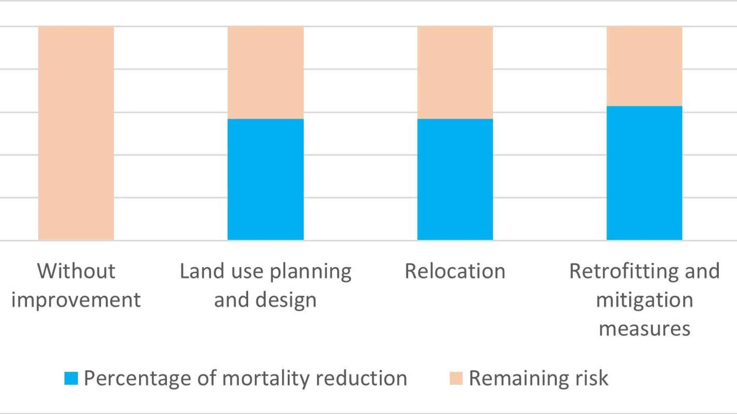
To save lives and reduce economic losses, the best course of action is to implement a set of interventions that include the land use planning, relocation, retrofitting and mitigation measures (See Figure 2). Backed by seismic micro-zonation in areas known to be at risk from large future quakes and spatial land use planning, it is time to redouble efforts to construct or retrofit buildings, and critical infrastructure to meet seismic loading needs. These interventions will pay off in lives and property saved.

The UN has launched a three-month flash appeal for US$1 billion to support more than 5 million people affected.