According to Swiss Re, re/insured losses from catastrophes hit $112 billion in 2021, with winter storms accounting for more than 50% of total losses, highlighting the country’s vulnerability to such events. This risk is notably increasing due to climate change, suggesting that a fundamental increase in flood protection tools is required. Ambiental’s data and technologies provide useful predictive tools to understand current and future flood risks.
Switzerland’s propensity to flooding
As a densely populated Alpine country, Switzerland is particularly vulnerable to natural hazards, especially floods. The country has over 1422 km² of lake areas, and 65,300 km of watercourses, rendering it exposed to any increases in precipitation. Switzerland’s watercourses are also constrained, with little capacity for accommodating flood peaks, which increases the damages caused when dikes are flooded.
This vulnerability is growing as areas at risk are being used more intensively the concentration of material assets and infrastructures in the areas at risk is increasing. Climate change will expose the country to even more natural hazards, notably because of glacier retreats, which will change the natural water flow regimes of Swiss rivers. Hence, after having been stable for more than 100 years, the severe storms increased in frequency in Switzerland from the 1970s.
Despite measures taken to mitigate those risks, lack of river maintenance, lack of water management schemes, insufficient legislation, concreting of the riverbanks, and the waterproofing of urban areas, are aggravating factors for floods. As a result, flooding in Switzerland is the most prevalent natural peril.
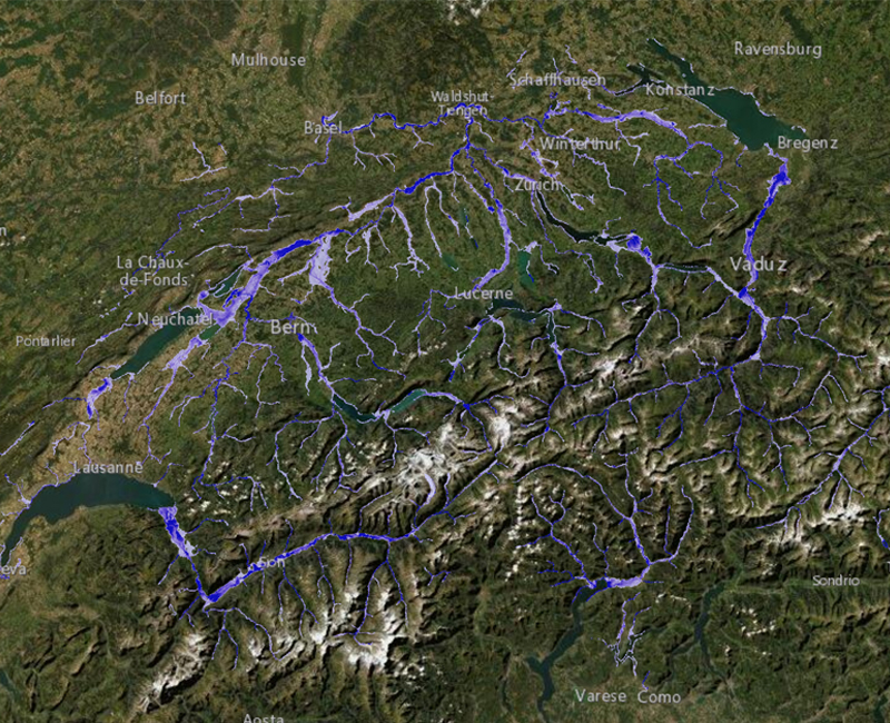
Large floods in mountain basins are becoming more frequent, a trend that is likely to continue with climate change, leading to changes in timing and amount of run-off in river basins. Some of the most vulnerable areas are the western part of the country, the Alpine Foothills, and Central and Eastern Switzerland.A rising number of properties are in areas exposed to floods in Central Switzerland and mountainous cantons.
Generally, urban, and rural communities living around mountain valleys and floodplains are affected by flooding. The Sihl River Valley, in the Canton of Schwyz, which flows from Drusberg to the Canton of Zurich, is prone to flash floods. Its lower part represents the largest flood threat as it flows beneath the main railway station of Zurich. Large numbers of properties are also vulnerable in the Zurich Area.
Historical flooding in Switzerland
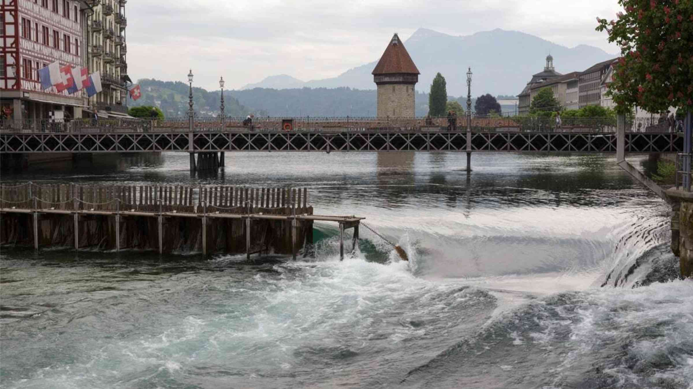
The 2005 flood is one of the most severe events that has impacted the country. It led to the death of six people, and caused extensive financial losses amounting to CFH 3 billion. The event caused extensive damage to stream and river courses, houses, commercial and industrial operations, transport routes, infrastructures, and agricultural lands. Entire valleys were cut off from the world for days. The Swiss Central Plateau was flooded along the rivers Aare and Reuss, and several lakes flooded theirs shores such as Lake Thun, Lake Biel, and Lake Lucerne.
This event caused the most extensive financial losses ever caused by a single natural event in the country. The 2005 flood mainly damage private structures and materials assets. As a result, individuals and companies, and their insurance companies, bore the highest burden of the damages (CHF 2 billion). The remaining CHF 1 billion damages affected public infrastructures and railways. The 2005 flooding in Switzerland highlights the vulnerability of the private sector, and the need for insurance providers, mortgage lenders, and property professionals to be better equipped to prepare for flood.
Another significant flood occurred in 2007 and is considered the fourth flood of the century in Switzerland since 1999. The event particularly impacted the Laufental Valley and the district capital of Laufen, where the historic old town was flooded up to two metres. Various town centres were flooded, and three people were reported dead.
Other major flooding occurred in 2000, 2002, 2011 and 2013, causing extensive damages to communities and properties.
Recent flooding in Switzerland
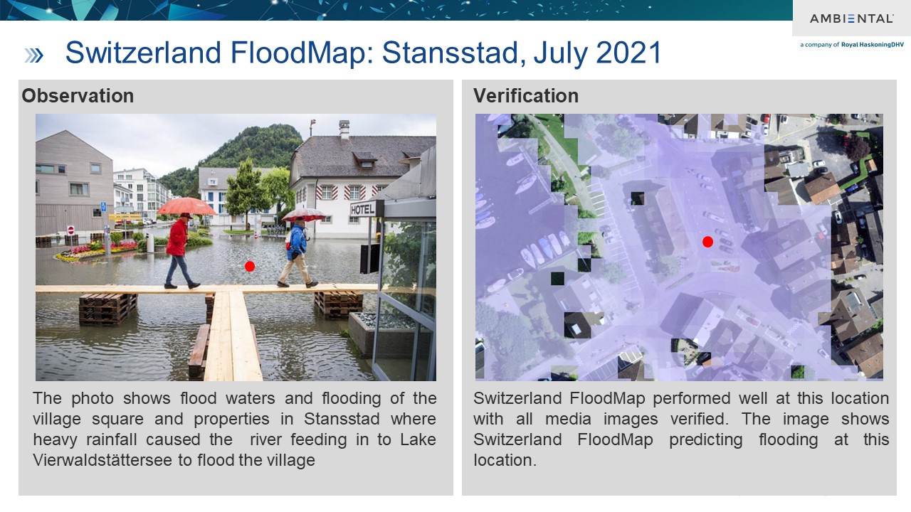
During the past decade there have been numerous flood events in Switzerland, causing many deaths and extensive damage to properties and infrastructure. Between 2014 and 2019 three severe flooding events impacted communities greatly and caused the deaths of several people The most recent flooding in 2021 impacted greatly the Lucerne Canton, roads were flooding in many cantons, with vehicles swept along streets into the Kleine Emme River.
Climate change and flooding in Switzerland
With a warming climate, more precipitations will fall in the form of rain instead of snow, increasing the risk of floods. One example is the Lower Grindelwald Glacier: to prevent floods, the meltwater of the glacier has been regulated using a drainage system since 2010. Whilst no definitive statement can be made on the future of climate change impact in Switzerland, it seems evident that the risk of flooding will rise in the next decades.
Even if the occurrence rates are similar, the damages due to extreme weather events are increasing in Switzerland. This is due to climate change impacting the intensity and widening the geographical distribution of meteorological extreme events. Ambiental’s flood maps provide accurate and up-to-date data that insurers, mortgage lenders, property professionals and data providers, as well as local government representatives, to make better selection and valuation decisions regarding flood risks.
Flood events do not differentiate between borders and often impact several countries simultaneously. Ambiental’s flood maps cover most of Western Europe at a national scale and cover surface water, river, and coastal flooding. Built at high resolution (5m), Ambiental flood maps offer a complete, and consistent view of flood risk for large areas.
Ambiental’s technologies are used to analyse data to understand and predict pluvial, fluvial, and tidal flood sources, detecting future and current changes in river flow and zones at risk. Our Climate Suite data products offer customers long-term risk insights and decision-making capabilities.
As climate change consequences are unknown and ever-changing, Ambiental’s FloodScore climate database helps customers stay up-to-date with data and risk assessments for every property. This powerful technology takes in the likelihood of an individual property being flooded and the damageability for different property classes. Its data is used to reflect on the average annual loss (AAL) and formulate a risk index.

 How to mitigate those risks?
According to Swiss Re, in recent years, 71% of claim burdens were accounting for flood losses, affecting the entire insurance industry, and losses are increasing each year. It is estimated that the run-off values for the river Engelbergeraa in the cantons of Obwalden and Nidwalden increased by 50%.
Since the risk of flooding in Switzerland is increasing, historical data is not enough to be fully prepared for future events. More up-to-date technology is vital to develop the understanding of floods events, their potential impact, and the zones most at risk. Ambiental’s market leading flood maps enable:
- The prediction of flooding in Switzerland
- Detection of locations at risk
- Preparation of defence mechanisms
- The review and adaptation of risk pricing for insurers
- Better decision making.
Whilst most measures taken by the government were efficient, floods damages are on the rise, with recent events highlighting the need for further actions. Ambiental’s products and services provide essential technological solutions for predicting and understanding the risk of flooding in Switzerland, and to help insurers, mortgage lenders, property professionals and data providers, as well as local government representatives, understand and reduce the risk of floods.