UPEACE: A disaster risk reduction policy for the Mount Cameroon Region
by Oluwole Olusegun Akiyode & Awa Mangie Achu Samba, UPEACE alumni from the programme of Environmental Security and Peace
Every region and/or state needs to develop a framework to reduce risk associated with disasters or design methodologies for preventing disaster, especially with the wave of disaster spreading worldwide from natural hazards. Thus, appropriate and sustainable policy should be advocated and implemented as a way of ameliorating these unavoidable occurrences.
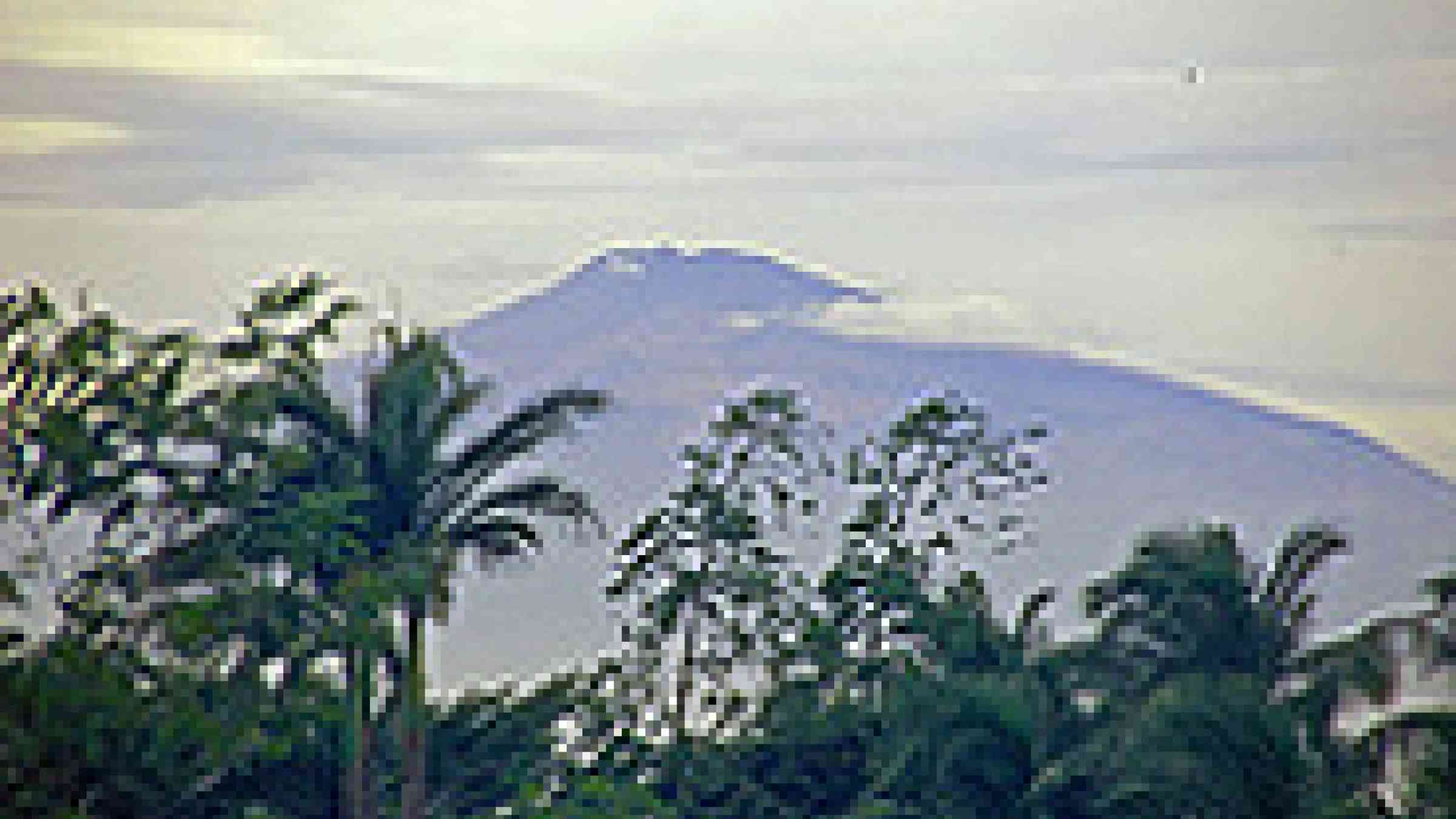
Mount Cameroon usually called the “Chariot of the gods” or commonly called Mount Fako, well known for its spate of eruptions. The paper shall analyze, through historic perspectives, developmental antecedents of residents and indigenous communities of the Mount Fako, to suggest the need of an effective disaster risk reduction policy for the region.
Introduction
Natural phenomenon may not be preventable, but the risk of disaster can be reduced through workable and thoughtful sustainable approaches. Active volcanoes the world over have been known to be one of the fearful hazards that may not be preventable, but the risk associated could be reduced by preparation, prevention, and mitigation.
It is estimated that about 10% of the world lives within proximity of active and potential active volcanoes (Tilling 2005:55). Thus, every state and region concerned needs to identify appropriate strategies for risk reduction.
Volcanoes are associated with tectonic plate margins and destruction always comes as a result of a process called subduction, where the edge of a tectonic plate drops beneath another (Francis 2004, Signurdson 2000 in Hansel 2006:149). When this happens, volcanic activities take place with disastrous effects.
Volcanic eruption could lead to health hazards affecting areas that are hundreds or thousands kilometers away with airborne dispersion of gases, ash, water, and impacts on the climate (Hansell 2006:149). This study focuses on Mount Cameroon, which is the highest mountain in Central West Africa and one of the most active volcanoes in Africa. The paper analyses the historical, cultural and socioeconomic activities associated with the past eruptions of the mountain and at end profess recommendations that will bring about a sustainable policy that will reduce risks associated with the ongoing hazards.
Mount Cameroon
Mount Cameroon is known by several names; locally called Mount Fako (the name of the higher of the two peaks); Mongo ma Ndemi in the local (Bakweri) language, which means Mountain of Greatness; likewise “Chariots of the Gods” for its frequent release of fire (volcanic eruptions). The Cameroon Volcanic line extends for more than 1600 kilometers, trending N300 E. Several recorded major disasters have occurred; in 1984 and 1986 when Mt Cameroon released toxic gas in lakes Monoun and Nyos, killing 37 and 1746 people (S.V.E undated).
According to the Smithsonian Institution Global Volcanism Program Website, (1999), “Mount Cameroon rises over 4 kilometers (2.5 miles) above the coast of western Cameroon with its historical activity which consist of moderate explosive and effusive eruptions from both summit and flank vents with numerous small cinder cones dot the flanks and surrounding lowlands.”
The stratovolcano, which is the second most active volcano in Africa, adorning the Gulf of Guinea in West Africa (040 131N, 090 100E) had seven eruptions in the last century (Njome et al 2009:533). It is said that “Stratovolcanoes have potential of major eruptions and often represents ongoing hazards” (Turban & Whiteford 2002:29). The last two eruptions were in 1999 and 2000.
Apart from the destruction of plantations and economic activities in the mountainous region, the 1999 eruption was also accompanied by occasional small earthquakes and minor tremors around the base of the mountain, especially in Buea city (S.V.E undated).
The mountain and the Indigenous People
The indigenous people residing around Mount Cameroon have special attachment with the mountain. It is believed that “the people around the mountain have considered it holy, sacred, a living mountain” (Asante and Maza 2009:430). Also, it is noted that the indigenous people at the foot of Mount Cameroon hold the traditional belief that the eruption in 1982 took place because of the death of the Paramount ruler who they proclaimed was a representative of the Gods of the mountain; apparently the eruption started immediately after he was buried (Bakweriarama 2000). Thus, while updating and adopting effective policy, the socio-cultural beliefs of the indigenous people must be included in the strategies. It is also necessary to examine the socioeconomic aspect of the past eruptions.
Socioeconomic effect of Mount Cameroon eruptions
Like other volcanic eruptions, Mount Cameroon eruptions in the past have been associated with health implications due to ash and gas flow which are detrimental to human health. The eruption also has socioeconomic effects with implications on people’s livelihoods. The 1999 eruption destroyed forest ecosystems, plantations and houses and the lava flow also interrupted the coastal road between Bantoke and Bakingili (SVE undated). Thus, there is a need to update existing policy on risk reduction in the region to ameliorate the impact on the people in case of another eruption.
Policy formulation and recommendations
Policy development and formulation is important in disaster risk reduction. Tilling (2005:57), a renowned writer on volcano hazards said “we must be more resourceful to enjoying the long term benefits of volcanoes during their repose while planning for and coping with the short term hazardous consequences when they erupt”. Thus, not only formulation and adoption of policy but implementation and sustainability is essential for a disaster risk reduction mechanism. The following are processes that need to be incorporated in the expected sustainable policy for Mount Cameroon.
1. Development of effective volcano monitoring
To plan for risk reduction during volcano eruptions, there should be effective volcano monitoring studies. This is the only valid basis for the short-term forecast of future eruptions since data from historical eruptions indicates the accompanying volcanic unrest, which may include physical and/or chemical changes in the state of the volcano (Tilling 2008:3). During the 1999 eruption of the Mount Cameroon, it was recorded that only one seismograph out of the six expected to scientifically observe the mountain was working, thereby inhibiting necessary information.
2. Risk Communication System
Data collected during effective volcanic monitoring studies needs to be communicated to the community, as the level of risk “depends enormously on the society and the state of community be it rural, small city or mega city” (Sagala 2007). Thus, the risk communication process should be appropriate to the socio-cultural context (Cornin et al 2004a; 2004b in Sagala 2007).
The historical volcanic monitoring studies which engender risk communication assisted in the reduction of hazard in case of Rabaul city, which on September 19, 1994 following 27 hours of precursory seismicity erupted suddenly, but only five deaths were recorded (Tilling 2008:7).
3. Public Education
Public education is an important key in risk reduction. Education is the backbone of risk reduction. The community must be aware of the impending risk, warning systems and evacuating systems. This could be done through consistent electronic communication systems and public education through seminars. Risk education should also be included in school curriculum.
4. Seismic Coding for Buildings
In 1999, it was recorded that houses were destroyed during the tremor that preceded the eruption in the city of Buea, located directly at the base of the mountain (SVE, undated). Buildings are rarely constructed to withstand seismic activities in the adjoining settlements such as the cities of Buea, Bakingili, Batoke, Debundsha and Idenau. Thus, the planning law and building codes or seismic codes should be developed, adopted and enforced by the municipality, state and national government to forestall future destruction.
5. Emergency Response System
An emergency response system should be coordinated at all levels in case of an unforeseen eruption. This should include all forms of government, the state, and non-state actors. The traditional authorities including the chiefs and paramount heads are also relevant in emergency response, since they are closer to their subject than the national government.
Conclusion
Sustainable policy is a viable tool in disaster risk reduction, but must be implemented and sustained. This is not only in the hands of the government, but needs input and understanding from all stakeholders, including the non-state actors and the local communities. It is only with the involvement of all stakeholders that we can achieve sustainable disaster risk reduction.