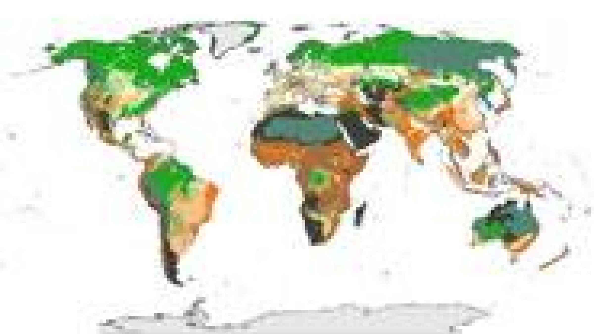
Using data from the world's ecosystems and predictions of how climate change will impact them, scientists from the Wildlife Conservation Society, the University of Queensland, and Stanford University have produced a roadmap that identifies the world's most vulnerable and least vulnerable areas in the Age of Climate Change, reports the Science Daily.
According to the report, the new map, the authors say, identifies southern and southeastern Asia, western and central Europe, eastern South America, and southern Australia as some of the most vulnerable regions. The analysis differs from previous climate change exposure assessments based on only climate change exposure which shows the most vulnerable regions as central Africa, northern South America, and northern Australia.
The full study appears in an online version of the journal Nature Climate Change.