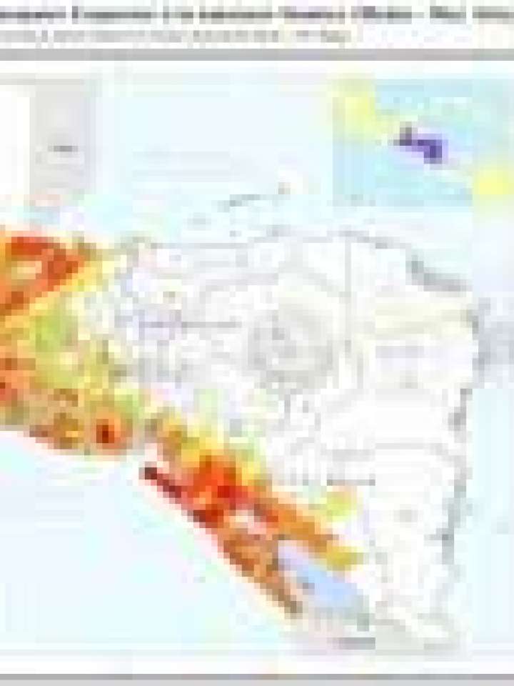
Central America: Total length of major roads exposed to seismic hazard (medium - very high)
The intention of this map is to give a quick overview for decision makers on national or regional level about the risk exposure of the road network to ‘medium – very high’ seismic hazard zones. The classification used here runs from yellow (few kilometers exposed) to red (many kilometers exposed). The class width of the yellow-to-red division has been chosen to facilitate the visual representation of the variability of values obtained in the assessment. White colored Municipios don’t have surveyed roads exposed to ‘medium - very high’ seismic hazard prone areas or the chosen seismic hazard is not relevant, either.
Explore further
Hazards
Earthquake
Country and region
El Salvador
Guatemala
Honduras
Nicaragua
Publication year
2010