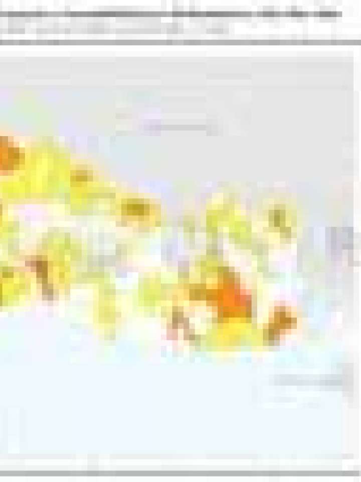
El Salvador: Healthcare facilities exposed to landslide susceptibility (high - very high)
The objective of this map is to give a quick synopsis for decision makers on national and sub-national level about the risk exposure of health care facilities in landslide prone areas (‘high’/’very high’ susceptibility). The classification used here runs from yellow (one facility is exposed) to red (more than three facilities are exposed).
White colored Municipios (see also the examples Municipios Jiquilisco and San Francisco Menendez in the table above) don’t have surveyed healthcare facilities exposed to ‘high’ and ‘very high’ landslide prone areas or the landslide hazard is not relevant.
Explore further
Hazards
Landslide
Themes
Health and health facilities
Risk identification and assessment
Structural safety
Critical infrastructure
Country and region
El Salvador
Publication year
2010