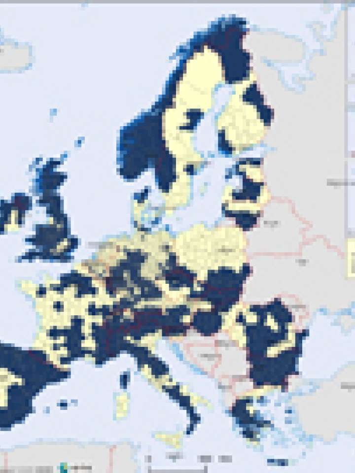
Europe: landslide hazard map
This map gives an overview of the landslide hazard in the NUTS3 clusters but does not assess in any detail in which parts of the regions landslides occur nor the causes of landslides (e.g. geology, relief, construction, etc.).
NUTS 3 levels are too coarse for pinpointing areas sensitive for landslides. In order to develop a first overview map on the problem of landslides in European regions, the ESPON Hazards project developed a questionnaire that was sent to all geological surveys of Europe. Based on expert opinion, the geological surveys were asked to mark those NUTS 3 areas of their respective country or region that have the possibility of landslide hazards in general terms. In order to keep the comparability of simply displaying the landslide hazard, probability and risk factors were excluded.
A striking point in the map is the large extent of the landslide hazard in European regions, showing that even though the total amount of losses due to landslides in Europe is not economically very significant (Munich Reinsurance Company, 2004), the hazard itself is rather widespread over the entire European territory.
Explore further