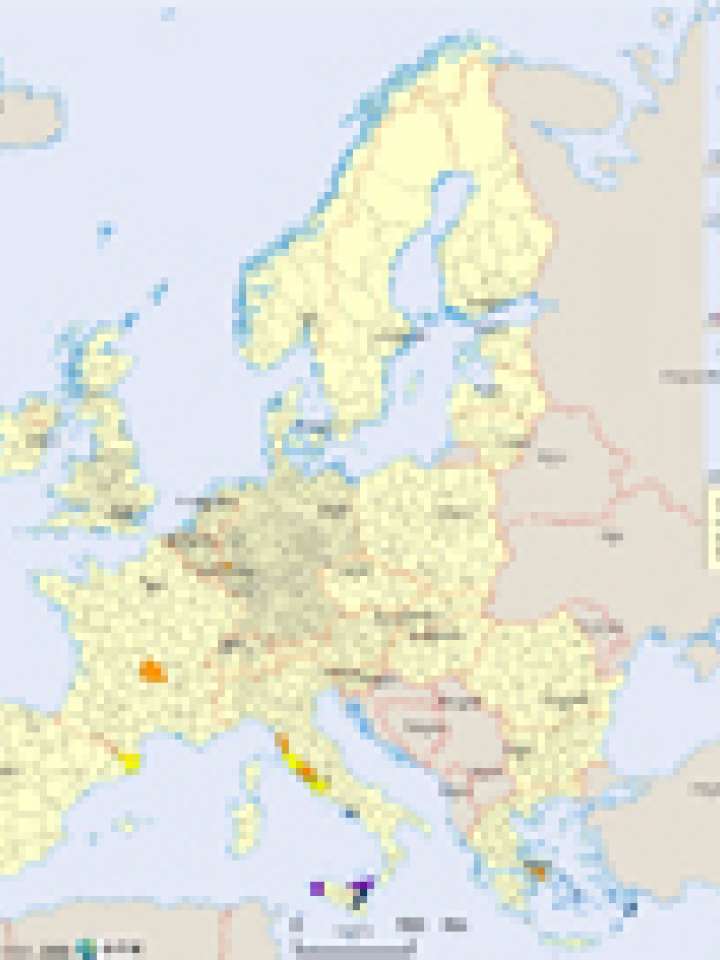
Europe: volcanic hazard map
The map displays regions with known volcanic activity eruptions during the last 10,000 years. The risk classification is based on the time when the last eruption has been occurred. The most dangerous volcanoes are identified by the International Association of Volcanology and Chemistry of the Earth's Interior (IAVCEI).
The highest volcanic eruption hazard is concentrated in southern Europe, i.e. Italy, Greece, and in the overseas territories. It must be considered that several Greek islands are clustered into NUTS3 levels, i.e. every island is not its own NUTS3 area. Therefore the volcanic hazard is also displayed on islands that are not volcanic.
In western Germany, The West Eifel volcanic field in the Rhineland district has been active at the end of the Pleistocene and beginning of the Holocene. In central France, the Massif Central has been an active volcanic field in the beginning of the Holocene. In Spain, the Quaternary Olot volcanic field has been active 11.500±1100 years BP (Global Smithsonian Program).
Explore further