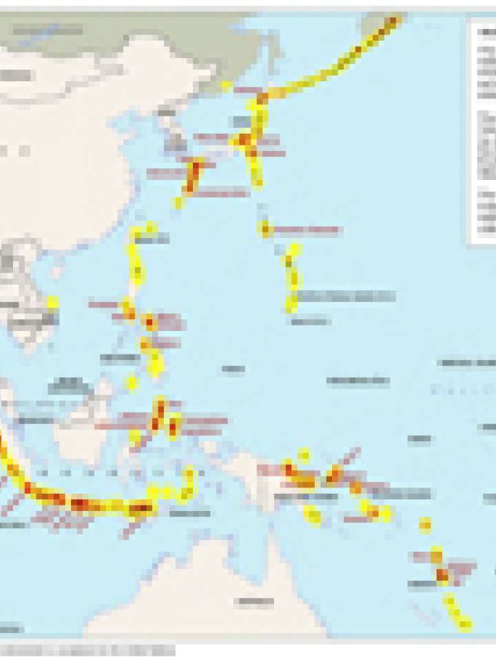
Holocene eruptions and selected volcanoes in Asia Pacific
This map illustrates the density of volcanic eruptions, rating every eruption with the Volcanic Explosivity Index (VEI). Eruption information is spread to 100 km beyond point source to indicate areas that could be affected by volcanic emissions aor ground shaking. The original source of data is a point dataset of worldwide historical volcanic eruption occurring within the last 10,000 years (to 2002).
Adapted from Simkin and Siebert, 1994 "Volcanoes of the World: an Illustrated Catalog of Holocene Volcanoes and their Eruptions" and produced digitally by the Smithsonian Institution's Global Vulcanism Program.
Explore further
Hazards
Volcano
Publication year
2006