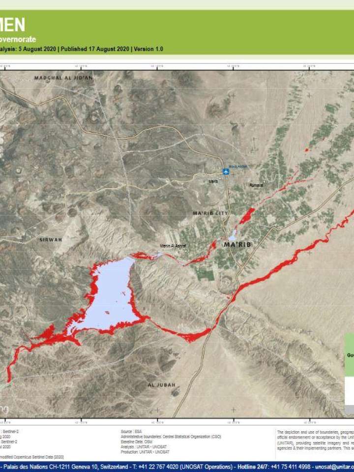
Satellite detected waters in Marib Governorate of Yemen as of 15 August 2020
Title in original language
Satellite detected waters in Marib Governorate of Yemen as of 15 August 2020
This map illustrates satellite-detected surface waters over Marib Governorate of Yemen as observed from a Sentinel-2 image acquired on 5 Aug 2020. Within the analyzed area of about 1,700 km2, a total of about 30 km2 of lands appear to be flooded.
Based on Worldpop population data and the detected surface waters, about 2,400 people may be potentially exposed or living close to flooded areas. This is a preliminary analysis and has not yet been validated in the field. Please send ground feedback to UNITAR-UNOSAT.
Explore further
Themes
Water
Country and region
Yemen
Publication year
2020