Central African Republic flood susceptibility & risk
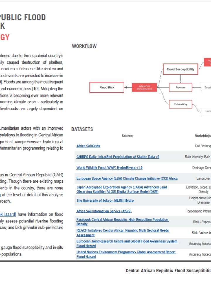
In late 2019, a destructive flood event that occurred in the months of October and November in the Central African Republic (CAR) occasioned the displacement of over 100,000 individuals and causing considerable damage. Through remote-sensing, REACH conducted a flood susceptibility analysis to classify areas within CAR that are more likely to flood, in an effort to inform enhanced preparedness. Results were then paired with indicators selected from the 2019 Multi-Sectoral Needs Assessment conducted across CAR, in order to develop a measure of relative consequential flood risk. The risk component accounts for where the impact on affected communities would be the worst, based on previously reported vulnerabilities. Based on needs and vulnerabilities reported by affected populations living in the most at-risk areas, the analysis showcased areas where the compounded impact of flooding would likely be the worst.
The analysis produced two outputs that are useful for planning response on the ground. First, a spatial representation of flood susceptibility, followed by a flood risk score for each prefecture and sub-prefecture assessed. Data revealed for example that the Ouham and Kemo prefectures have the highest flood risk, while Ouham Pendé and Nana-Mambéré prefectures have the lowest. These calculations are based on a combined measuring of exposure, vulnerability, and hazard to flooding. The flood risk score involved clipping the flood susceptibility layer to just the inhabited areas. This revealed that a significant portion of cities are highly susceptible to flooding. Many settlements in CAR re strategically located near rivers and tributaries which sustain the livelihoods of residents as a mode of transportation and means of sustenance. The banks of these waterways tend to overflow to accommodate the increasing amount of rainfall collected in these watersheds.
Explore further