By JoAnna Wendel
A still from a brief video of storms sweeping across southeastern Louisiana on 7 February. Tornadoes spawn in the thick mass of clouds in the upper right where concentrated bumpy regions indicate upwelling winds that may form tornadoes. NOAA’s newest weather satellite, GOES-16, took the images.
A brief video released last week shows tornadoes ripping through southeastern Louisiana—as seen from space. Released by the National Oceanic and Atmospheric Administration (NOAA) last Wednesday, the video shows a sequence of images captured the previous day by the agency’s new weather satellite, Geostationary Operational Environmental Satellite 16 (GOES-16).
NOAA meteorologists said the clip demonstrates the enhanced ability of new satellites to provide bird’s-eye views of extreme weather as it develops. GOES-16, which is the first in NOAA’s new GOES-R satellite series, launched on 19 November 2016.
Real-Time Resolution
The tornadoes injured dozens and caused major damage to parts of New Orleans, particularly in the eastern part of the city. In all, nine tornadoes touched ground, NOAA reported. Here’s a video of one of them, as recorded from a nearby hospital window.
In the video of the storms as seen by the NOAA satellite, wispy clouds in the west become an expansive rolling mass to the east. Bubbly, cauliflower-shaped features arising from this churning stew are the storms that caused the tornadoes, said Steven Goodman, senior scientist for the GOES-16 satellite. The frothing shapes reflect vigorous upwelling of wind, which helps form the tornado’s funnel shape.
A More Watchful Eye
From an earlier generation of satellites that remain in operation, meteorologists get updates about every 15 to 30 minutes. By contrast, GOES-16 scans the continental United States every 5 minutes.
With this new scanning frequency, “even before the radar shows you typical [tornado] signs, you’ve got some real indication that the storm environment is changing to a dangerous situation,” Goodman said, which gives meteorologists better tools with which to warn the public of the coming danger. Goodman estimates that data from the new satellite may give affected areas 5-6 minutes more lead time to prepare for a storm—a nearly 50% increase from the prior 13-minute average.
Future of Forecasting
Once the satellite is fully operational this November, images like those in the video will allow meteorologists to track a storm in almost real time.
Currently, NOAA scientists are testing and calibrating the satellite to ensure the accuracy of readings, so its images remain experimental. However, once the satellite is fully operational this November, images like those in the video, taken by its Advanced Baseline Imager, will allow meteorologists to track a storm in almost real time, Goodman said.
He hopes that the highly resolved data will “personalize the risk a lot better.” Meteorologists already have trouble convincing the public of real and impending danger. Goodman suggested that having such rapidly updating information will help meteorologists and TV broadcasters better communicate hazard.
When it is fully operational, the satellite will image Earth every 30 seconds, with high-resolution images of the entire Earth disk every 15 seconds, the continental United States every 5 minutes, and areas of high storm activity every 60 seconds.
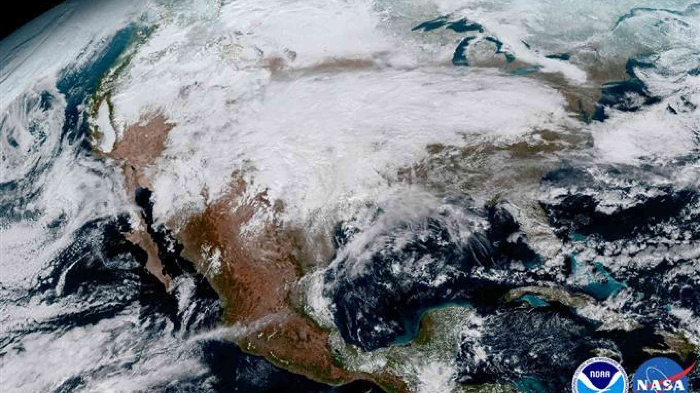
NOAA released the first images from GOES-16 on 15 January, showing a high-resolution view of Earth.
Creative Commons (CC BY-NC-ND 3.0 US)