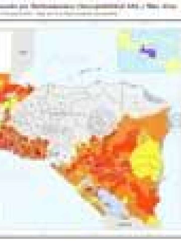
Central America: Economic potential at risk - High and very high landslide susceptibility
The intention of this map is to give a quick overview for decision makers on a supra-regional and national/subnational level about the economic potential that is at risk due to exposure to ‘high’ and ‘very high’ landslide susceptibility. The map actually summarizes the total amount of GDP exposed to high and very high susceptibility for each Municipio. The classification used here runs from yellow (economic potential exposed is low) to red (economic potential exposed is high) expressed in million US$. The class width of the yellow-to-red division has been chosen to facilitate the visual representation of the variability of values obtained in the assessment and to get a harmonized impression across national borders. White colored Municipios indicate that the chosen hazard (‘high’ and ‘very high’ landslide hazard) is not relevant, or in other words, the economic potential is not at risk.
Explore further