Improving Flood Preparedness at Communities in Nigeria through the Provision of Flood Early Warning Maps
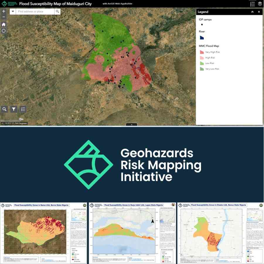
Deploy volunteer youths who possess excellent geospatial analysis and leverage on the geospatial technology and datasets to develop flood susceptibility maps and early warning platforms (indicating settlement, population, and farmland at risk) which can be accessible to community members to improve
Description
Deploy volunteer youths who possess excellent geospatial analysis and leverage on the geospatial technology and datasets to develop flood susceptibility maps and early warning platforms (indicating settlement, population, and farmland at risk) which can be accessible to community members to improve their adaptive capacity and flood preparedness at those communities within the following listed State in Nigeria: Adamawa, Benue, Borno, Lagos, Niger, and Kebbi State.
Share the maps with the National, State, and Local Emergency institutions before the onset of rainfall (April to November 2021) and liaise with the local media outlet who can communicate the flood susceptibility information to the people.
Develop a flood reporting web application, which the community can use to report real-time flood occurrence and information on destruction in the case of flood disaster, the submitted information will be shared with the National, State, and Local Emergency institution for effective flood response and disaster loss data compilation.
Did the Sendai Framework change or contribute to changes in your activities/organization? If so, how?
The Sendai Framework target G (“Substantially increase the availability of and access to multi-hazard early warning systems and disaster risk information and assessments to the people by 2030”) led to the founding of the initiative in the first place. We adopt the use of geospatial technology to contribute to increasing the urban and rural people’s access to flood early warning information and also supports the national and state emergency institution with disaster risk information.
What led you to make this commitment/initiative?
What was your position before making this Voluntary Commitment / prior to the Sendai Framework?
At every rainfall season in Nigeria, vulnerable communities are constantly being impacted by flood occurrences which causes a decline in farm crop output, displacement of people and loss of livelihood and decline of income. Despite the effort of the national governments in reducing risks of flood, communities members (most especially the farmers and the dependency proportion (elders and children) of the population) often time complains about their of lack of awareness and access to flood early warning information which could have helped them to be better prepared for these floods.
Deliverables and Progress report
Deliverables
Deliverables are the end-products of the initiative/commitment, which can include issuance of publications or knowledge products, outcomes of workshops, training programs, videos, links, photographs, etc.
Created Flood maps (25 counties within the following states: Adamawa, Borno, Lagos, Niger) indicating settlement, population, and farmland's level of susceptibility to flooding occurrence. Also, develop a flood early warning platform that can be accessible to the community member. Build a flood reporting application to that is accessible to the public to report flood disaster loss. Hosted an event that brought together 55 youths who contributed to mapping building footprints and road networks using the geospatial platform (https://www.missingmaps.org/)
Organizations and focal points
Implementing Organization(s)
Focal points
If a VC's contact information has been hidden, the SFVC team can forward a message.Partners
